More routes to consider.
Three State Tour: Cross the boarder from WV in PA on a wooden toll bridge ($.50). The bridge has no sides, so stay straight. As long as the conditions are dry, this is expected to be a casual ride on easy forest roads in Maryland. Once in PA this becomes a fantastic twisty paved ride to Breezewood at the north end of the route. Lots of food choices in Breezewood. The ride south from Breezewood also a great twisty ride. There is no ovelry challenging terrain anticipated in this route unless there are wet conditions. If wet you may want to find a way around the Green Ridge Forest section in MD.
Beware that Green Ridge Forest is actively patrolled. Their rangers will not hesitate to write you a ticket...this is Maryland.
Map:
http://ridewithgps.com/routes/7491872
(note you can download a .gpx file from this site by clicking the Export tab near the top right of the page)
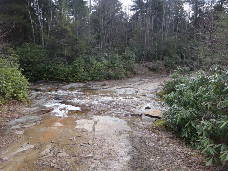
Green Ridge Forest Road
 Mountains and Mud
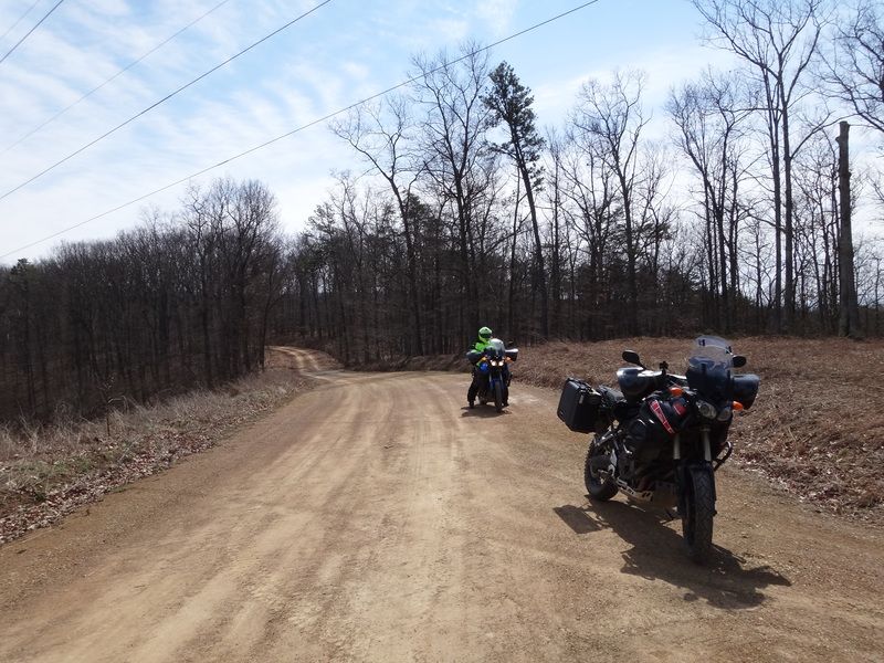
: Recommend knobbies and skidplate. Big bike pilots may find this challenging. You should be very comfortable in the dirt to consider this ride. This route contains everything. Greenland Gap is a road woth slowing down to take in the waterfalls. Then up Mt Storm on banked twisty roads. Out to some nice twisties on Rt 50, then let the steep mountain dirt road begin. Up, down and up again. I've ridden two of the three mountains, they were both great. Looking forward to checking out the thrid. This course was layed out in this direction because the third mountain is steep enough it would be a handful to wrestle gravity with your brakes on a big bike. Easier to defeat gravity with the engine going up.
Next up is the mud, of course that depends on recent rain. Canyon Ridge Road, aka Douglas Road, very fun, can be considered rough. A rock base road that will have you picking lines the entire length. No significant elevation changes. There can be a lot of mud holes, and there are two minor water crossings. This road is a real treat, not too difficult, but not for those looking for a smooth forest road.
Many other fun features of this ride, including one of my favorite out and back ride over the mountian to the river. Love that one.
This route does include Dolly Sods. There are many places from which this ride can be cut short.
Map:
http://ridewithgps.com/routes/7491869
(note you can download a .gpx file from this site by clicking the Export tab near the top right of the page)
Canyon Ridge Road

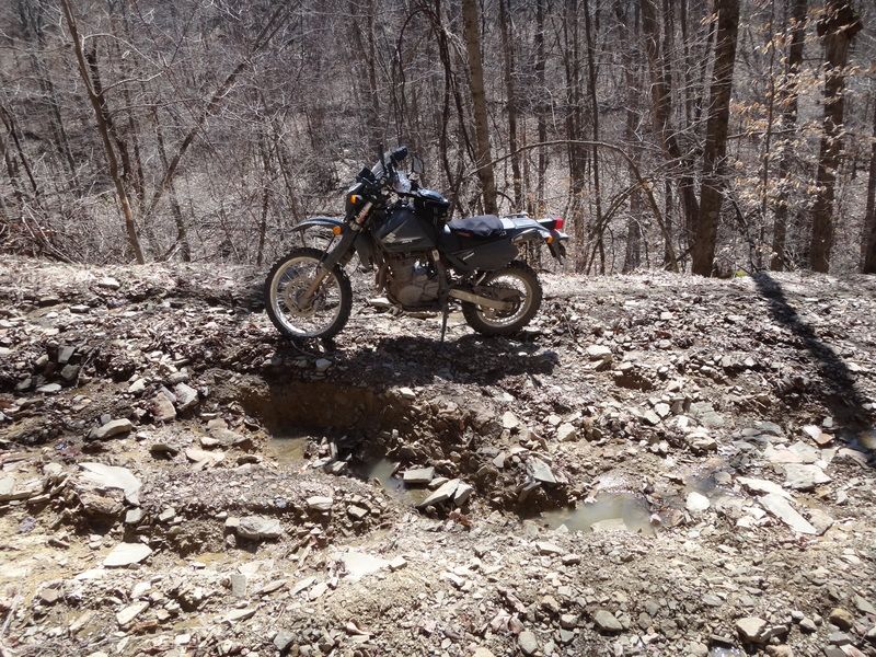
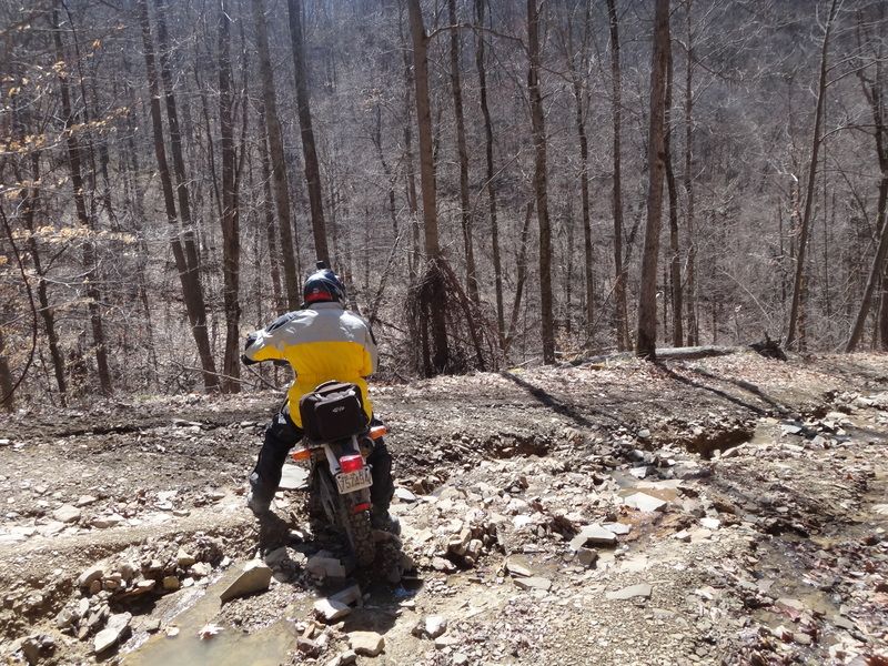
 Rough Road
: Due to the horrible conditions on Cravens Run Road this route is not recommended for big bikes. It can be done, but it made me stop and laugh even on my DR. The road is in very bad condition.
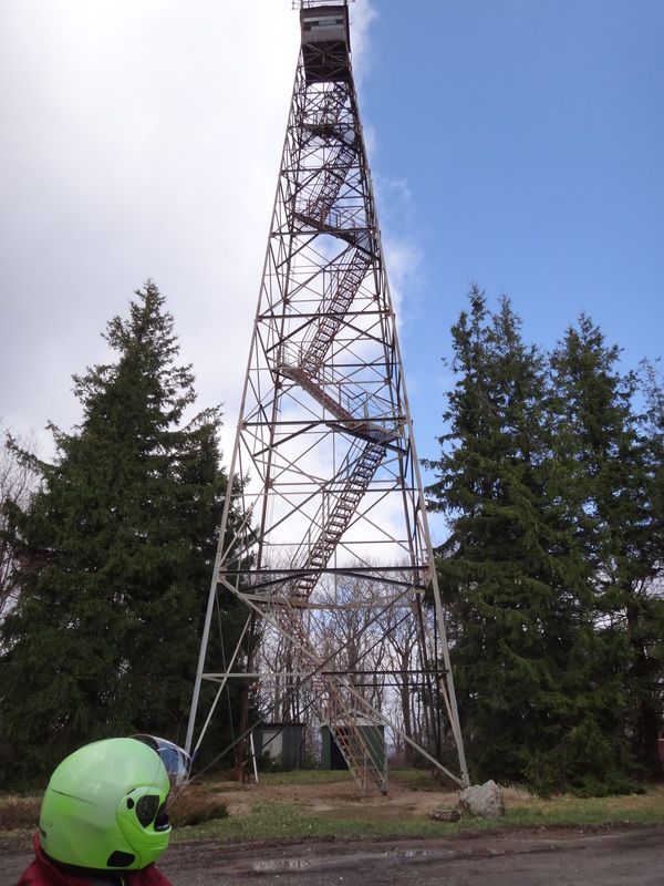
This is a ride from Blackwater Falls to Dolly Sods. It includes the fun and rough Canyon Ridge Road with some minor (but interesting) water crossings. An out and back to a fire lookout tower. The high dirt road along the river, with a lot of nice elevation changes. It has the amazingly torn up Cravens Run Road. Also inclues a favorite out and back ride over the mountian to the river. Love that one. It then take you to to Dolly Sods. You can use some of the other published routes to figure out a good way back to Romeny.
Map:
http://ridewithgps.com/routes/7499263
(note you can download a .gpx file from this site by clicking the Export tab near the top right of the page)
Cravens Run Road
Fire Tower
 Canaan Loop
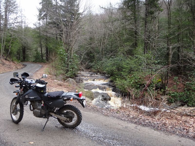
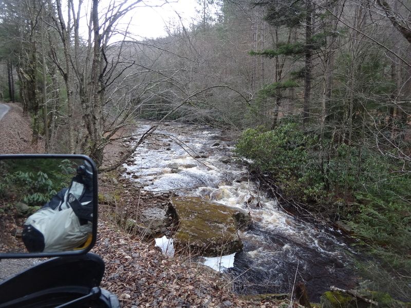
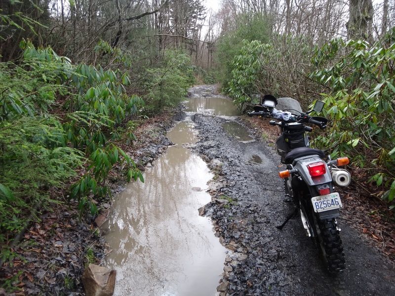
 - Nice easy ride on the southern section. Could be done on a sport bike for the first 10 miles. Once it becomes rough it stays rough. Cannot do the full loop due to water crossing being too deep.
Example of nice section. Easy dirt for about 10 miles.
Example of rough stuff
Impassable water crossing (6+ feet deep)

View from inside Blackwater Falls park
 Sport Touring
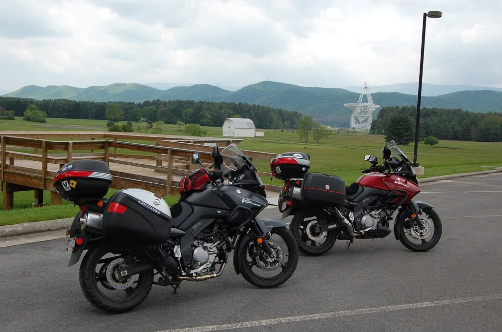
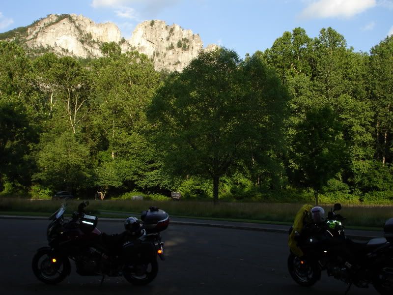
: This is an all paved route that includes sweeping overlooks, a ride to the 500' wide Green Bank Telescope, great mountain twisties, the Cass Railroad Station, a visit to Seneca Rock, then back. The tour at Green Bank Telescope is worth a stop. If you find you are running out of time you can easily backtrack from the telescope to ride the twisties of Rt 250.
Note - if you do cross the Virginia border on Rt 250 for the twisties, watch your speed. We have horrible speeding laws in VA (20 over and you're coming back).
Map:
Sport Tour - Greenbank Telescope