Thanks again to all who contributed to my decision to buy a GPS. I am happy to report, the new Garmin 1490LMT GPS, RAM mount and such I ordered have been mounted and working well.
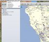
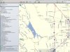
First thing I did was go to Garmin's Basecamp sight to see if I could create a route and follow it. Although it wasn't as smooth as Google Maps, it was similar in design and I was able to intuit my way through, no problem. I created a route to Best Buy in a few short minutes, via backroads, to purchase a micro-SD card for the updates to fit on (NOTE: internal memory was almost full out-of-the-box) It was a cinch, to transfer the file with the click of the mouse. Once on the bike, it took only a couple minutes to find the route and begin following it.
FIRST IMPRESSIONS:
IMAGE QUALITY: GOOD, PLENTY BRIGHT (AT DUSK {with polarized brown sunglasses on}- more on that later as I use it during the day)
TOUCH SCREEN: ACCURATE, ABLE TO USE WITH LEATHER GLOVES (HOORAY!)
INTERFACE: INTUITIVE AND UN-CLUTTERED. NO COMPLAINTS THERE
IN-MOTION DETAIL: EASY ENOUGH TO FOLLOW, AS USUAL- SOME STREETS COME UP FASTER THAN THE "40 FEET, LEFT TURN" WOULD INDICATE... BUT THE ICON OF MY MOTO ON THE MAP WAS MORE ACCURATE, AND SHOULD ELIMINATE CONFUSION OVER MOST TURN-BY-TURN NAVIGATIONS AS I CAN ANTICIPATE IT.
IN-MOTION ADJUSTMENTS: EASY TO NAVIGATE THE ZOOM, SCROLL AND EVEN OPTIONS AS THE G.U.I. IS SIMPLE AND UN-CLUTTERED.
RAM MOUNT: I BOUGHT THE HANDLE BAR MOUNT, IN 3" RISE, AND IT WORKS PERFECTLY. OUT OF MY MAIN LINE-OF-SIGHT SO AS NOT TO BE A DISTRACTION, BUT JUST UNDER MY NOSE WHEN I NEED IT. PLUS, I CAN REACH THE SCREEN TO ZOOM IN/OUT EASILY AS IT'S JUST 8-9 INCHES FROM MY LEFT HAND. VIBRATIONS ARE MINIMAL, BUT I WILL STACK UP THE RUBBER SHIMS I INSTALLED TO FURTHER MINIMIZE IT. ( I also bought a cheap-O "water-proof" case for 5" GPS's that came with a mount. More on that once I try it.).
I thought I'd mention this unit and my initial satisfaction because, according to the GARMIN REP, it is one of the few that can still be purchased new that allow for "MULTI-POINT ROUTING," something I couldn't see living without. I have been plotting my adventures on Googlemaps, then following them from memory (mostly- pulling out the iPhone once in awhile to check or alter routes). This unit allows me to plot the route I dream up on Garmin's free website, Basecamp, and then quickly download it into the GPS and go ride it. I heard from the Garmin Rep that, besides the dedicated (and very expensive) MOTO GPS's and hand-held Hiking versions (with their puny screens), these discontinued 1400 series units were among the remaining few that allowed this pre-ploting of routes, via a computer, and to be downloaded into them.
If you're like me, and you want to pre-plan your route to some extent, then go follow it - this might be the unit for you. I got mine for $169, and the RAM mount for $30-ish.
So, for $200 I have:
One of the best brands out there,
Lifetime free map updates AND traffic,
A bright 5" color screen that works with gloves (leather)
Multi-route plotting & downloadability
A solid and highly adjustable mount AND a water-resistant case
Needless to say, I'm stoked!