14kmtnman
Well-Known Member
I hit the slopes yesterday. Back when I was a kid, my parents belonged to a Jeep club. One of the trips I remember is going to Breckenridge CO. There were several mining cabins back then that had newspapers glued on the inside of the log walls to help with insulation. It was fun to read the old print. On that same trip we wound up on top of what is now Peak 8, 9 and 10. Now this was many many years ago back in the infancy of the Ski area in the early to mid 1960's. A lot of the roads are now blocked off, but I found one that headed up to Peak 9. To get to the road you have to go through a parking lot. It was maintained, but had a lot of loose gravel and very sharp hairpins the higher up I went.
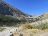
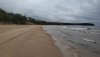
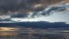
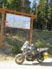
This is close to where the road starts up.
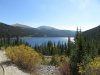
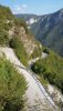
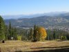
Part way up looking back towards Breckenridge
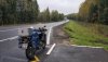
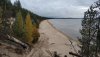
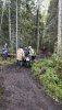
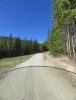
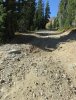
Some of the lower sections looked like this
Made it to the Peak 9 Overlook lodge. The place was closed with no one around.
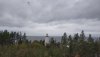
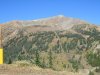
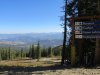
This is looking across to Peak 8. You can just make out the top of the ski lift, just to the right of the peak. The black dots
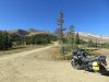
This is looking up the hill where I am heading next. From here on up the road is much rougher and steeper. I make it to the top of 2 lift runs.
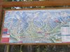
The map at the end of the lift. Peak 9 run is the 2nd from the left. Peak 8 is the tallest in the middle.
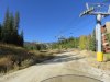
You can see how much snow they get by how tall the sign is
Looking down the run
Around the next corner, It turns steeper, rockier and looser. This is where I turn around. It was kind of tricky turning around because of the big holes caused by 4x4's, the steepness and the rocks. I came this close to falling to the downward facing hillside because of a big hole. If I had been on a bit taller bike it would have been all over. This picture does not do it justice. Lots of rocks and holes hiding in the shadows. The road continues up for about another mile and dead ends per my maps.
This is close to where the road starts up.
Part way up looking back towards Breckenridge
Some of the lower sections looked like this
Made it to the Peak 9 Overlook lodge. The place was closed with no one around.
This is looking across to Peak 8. You can just make out the top of the ski lift, just to the right of the peak. The black dots
This is looking up the hill where I am heading next. From here on up the road is much rougher and steeper. I make it to the top of 2 lift runs.
The map at the end of the lift. Peak 9 run is the 2nd from the left. Peak 8 is the tallest in the middle.
You can see how much snow they get by how tall the sign is
Looking down the run
Around the next corner, It turns steeper, rockier and looser. This is where I turn around. It was kind of tricky turning around because of the big holes caused by 4x4's, the steepness and the rocks. I came this close to falling to the downward facing hillside because of a big hole. If I had been on a bit taller bike it would have been all over. This picture does not do it justice. Lots of rocks and holes hiding in the shadows. The road continues up for about another mile and dead ends per my maps.
Last edited: