Two Amigos explore southern Utah. Super-Tenere and V-Strom 650.

SkunkWorks

Well-Known Member
Joined
Sep 13, 2018
Messages
1,771
Location
Colorado
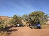
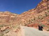
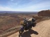
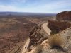
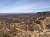
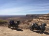
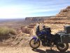
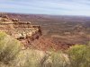
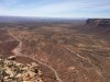
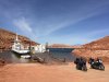
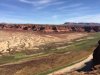
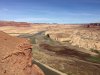
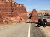
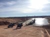
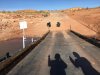
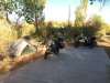
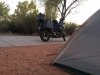
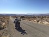
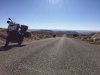
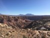
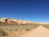
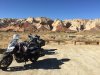
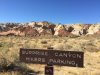
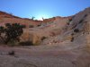
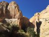
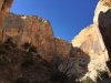
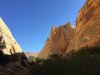
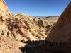
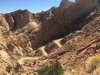
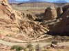
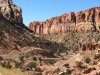
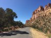
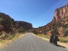
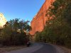
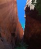
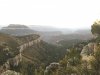
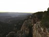
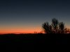
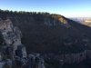
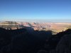
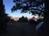
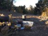
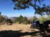
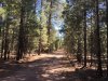
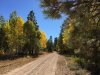
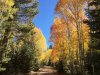
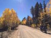
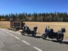
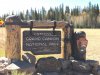
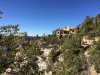
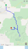
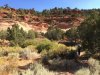
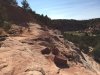
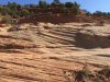
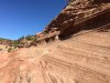
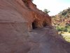
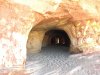
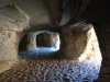
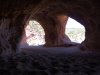
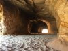
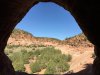
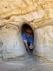
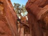
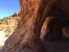
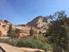
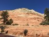
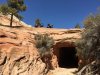
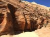
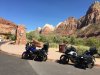
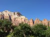
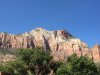
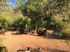
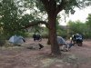
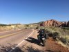
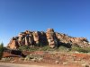
PSA - For anyone Camping at the Willow-Springs Camping area, north of Moab:

If it's windy, make sure you have your Rain-Fly on your Tent, and zipped up all the way! (I left mine unzipped for awhile while we were hanging out in the evening)
The fine sand will blow right through the screen on your Tent, and will cover everything.

I had to take extra time to dump the sand out of everything the next morning before packing it away.
 

SkunkWorks

Well-Known Member
Joined
Sep 13, 2018
Messages
1,771
Location
Colorado
Day-3
380 Miles

After coffee and breakfast, and dumping the sand out of everything................................We packed up the bikes and got ready to start our Day.

IMG_7622.JPG

It was a gorgeous day as we made our way through Moab, and headed south on US Hwy-191.

We had an easy ride through the Towns of Monticello, Blanding, and Bluff on our way to the turn-off for Hwy 261 just north of Mexican Hat.
It wasn't long before reaching the Moki Dugway.
I had never ridden this, and it was on both our lists.

From the bottom, the road disappears into the rock layers in the side of the Cliff.
IMG_7624.JPG

IMG_7626.JPG

IMG_7625.JPG

IMG_7629.JPG

IMG_7631.JPG

IMG_7632.JPG

IMG_7635.JPG


You gain around 1100-feet from the bottom to the top.
IMG_7639.JPG

After getting our fill of scenery at Moki Dugway, we continued north and turned west on Hwy-95.

A short time later, we made the turn on Hwy-276 heading towards Hall's Crossing.
It was at this time that we noticed the lighted Sign-Board next to the road that read "Ferry Closed"..........................
Leading up to this trip for about a Month prior, I had been researching the Ferry crossing via their website.
There were a couple times that it went out of service temporarily, and resumed a short time later.
I had been diligently watching the Lake Powell water level, and during the time of our trip it would still be above safe depth.
We both were looking forward to taking the short trip across the water, and even the day before leaving Home on this trip their website stated that Ferry service was scheduled to resume on Saturday the 26th.
It was still early in the day, and we secretly hoped that maybe they forgot to change their sign.
There were other cars and trucks headed that way, so we rode on towards Hall's Crossing.

When we arrived we found the Ramp blocked with traffic-cones, and the Ferry silently parked at the loading-Ramp..................No Service!

IMG_7644.JPG
This was a huge Let-Down...............
The view across was Torture! We just want to go "Right Over There!"
 

SkunkWorks

Well-Known Member
Joined
Sep 13, 2018
Messages
1,771
Location
Colorado
To continue on Hwy-276 by Ferry, the water crossing is just a bit over 4-miles from pavement to pavement.
The alternative is 146-miles by road!

At least it was still early in the day...............................We topped up with Fuel at the Chevron Station in Hall's Crossing, and set-off "The Long Way Around".

We made good time, and stopped at the Hite Overlook.
During times of high lake levels, this would be all filled in with Lake Powell.


The "Boat Ramp" on the other side of the River shows where water can sometimes be...................
IMG_7647.JPG

The Colorado River, where it meets the top of Lake Powell.
IMG_7645.JPG

IMG_7653.JPG

Hwy-95 is actually a really fun ride through the Canyons, and it didn't take long before we found ourselves turning down the other end of Hwy-276.
We made our way south towards Bullfrog, and made it a point to ride all the way to the end of the pavement on this side.

IMG_7655.JPG

We walked up the loading-Ramp, and turned to proclaim our "Salute" to the Ferry being out-of-service.

IMG_7657.JPG

We rode over to the Marina to check out the insanely-long Boat Launch Ramp.
They certainly anticipate huge changes in lake surface levels.
IMG_7658.JPG

We made our way over to Bullfrog Basin Campground.
We cruised the loops to find a suitable Campsite, then settled in for the evening.

IMG_7659.JPG

IMG_7661.JPG

We were allowed a Campfire.
It was the perfect way to end the Day!

IMG_7662.JPG

Here's the 3D video of the Day's route.


And here's the basic map of the route.

IMG_7663.PNG
 

Mak10

Well-Known Member
Joined
Aug 20, 2018
Messages
2,567
Location
SE Idaho
Brings back good memories of riding the area. It’s sad to see numerous campgrounds around the Hite area that were once near the lake. Now they are high and dry kinda deserted looking.
I’ve yet to ride the ferry as well.
 

SkunkWorks

Well-Known Member
Joined
Sep 13, 2018
Messages
1,771
Location
Colorado
Day-4

303 Miles

After Breakfast and packing up Camp, we loaded the bikes and got ready for the day.
We topped up with Fuel and headed out on the Burr Trail.

IMG_7664.JPG


This is where I realized one of my headlight Bulbs was burned out.
IMG_7666.JPG

IMG_7667.JPG

The scenery was fantastic, but I was surprised to find the Burr Trail is paved most of the way.
There is only a short section of dirt where it crosses through Capital Reef National Park.

IMG_7669.JPG

It was still early in the morning, so we took the opportunity to do a short Hike into Surprise Canyon.

IMG_7670.JPG

IMG_7685.JPG

IMG_7672.JPG

IMG_7678.JPG

IMG_7679.JPG

IMG_7683.JPG
 
Last edited:

SkunkWorks

Well-Known Member
Joined
Sep 13, 2018
Messages
1,771
Location
Colorado
After our morning hike, we hopped back on the bikes.

Just a short way farther, the road quickly gains elevation up the Burr Trail Switchbacks.

IMG_7687.JPG

IMG_7688.JPG

IMG_7689.JPG

IMG_7691.JPG

We posed for pictures at the National Park Sign.
The road turns back to pavement just after you reach the top of the Switchbacks.

IMG_7692.JPG

IMG_7694.JPG

The road winds its way over Ridges and through the Canyons.
There was barely any traffic, and this part of the road was amazing!

IMG_7698.JPG

IMG_7699.JPG

IMG_7702.JPG

IMG_7705.JPG
 

SkunkWorks

Well-Known Member
Joined
Sep 13, 2018
Messages
1,771
Location
Colorado
We found this awesome Slot-Canyon right next to the Road.
We decided to stop and take a walk into it.
The lighting and the colors were amazing!

IMG_7708.JPG

IMG_7709.JPG

IMG_7711.JPG

IMG_7717.JPG

IMG_7718.JPG

IMG_7719.JPG

IMG_7724.JPG

We continued on and finished the Burr Trail at the town of Boulder.
We stopped to have lunch at the Burr Trail Grill, where we sat outside and ate while we decided on where to finish out the day.
We weighed our options as we calculated distances, and since we still had all afternoon, we made the decision to push on to the North Rim of the Grand Canyon.
I had been wanting to Camp at Locust Point for a couple years now, and had failed to get there the previous year due to Weather.
We made that our destination, and we knew we were going to have to Boogie to get there by the evening.

We wasted no time as we set out on Hwy-12.
Traffic was almost non-existent, and we enjoyed the "Roller-Coaster" sections of twisty road.
We did not stop to take any more pictures during this leg of the ride.

We stopped for Fuel in Escalante, and then continued on to US Hwy-89.
We turned south here and made good time as we rode to Kanab, where we topped up with Fuel once more before taking US Hwy-89A into Arizona.

We made our way up the Plateau to Jacob Lake, then turned south on Hwy-67.
A short time later we reached the turnoff onto dirt to start heading west towards Locust point.
Not knowing it at the time, my GPS was trying to take the most direct route to get there, which ended up leading us down this gnarly two-track Road Trail.
There were lots of rocks, logs across the road, sections with loose sand, and even a few soft-muddy areas with more rocks.
At this point the sun was getting really low, so we just pressed on............
It took us a bit longer to get there than it should have, but we arrived at Locust-Point just as the sun went below the horizon.

It started to get dark pretty quick, so we took a few pictures, set up our Tents, ate a hot meal and called it a night.
We were both pretty tired from the day's Ride.

IMG_7725.JPG

IMG_7726.JPG

IMG_7728.JPG

Here is the 3D video of the Route for Day-4


Stay Tuned!
 
Last edited:

SkunkWorks

Well-Known Member
Joined
Sep 13, 2018
Messages
1,771
Location
Colorado
Day-5

128 Miles

It was a COLD night (down into the 30's) but I had bundled-up with all the extra layers that I had with me, and it was fine in my sleeping-bag.
We woke up just after the Sun came up over the Horizon.
We took our time to enjoy the views, relax and eat breakfast with this amazing sight before us.

IMG_7731.JPG

IMG_7733.JPG

IMG_7734.JPG

IMG_7736.JPG

IMG_7738.JPG

IMG_7739.JPG

IMG_7740.JPG

IMG_7743.JPG

As we were packing up Camp and loading the Bikes, I noticed that my Fork-Seals were weeping slightly.
I figured i would keep an eye on them throughout the day, and decide later if they required attention.

IMG_7742.JPG
 

SkunkWorks

Well-Known Member
Joined
Sep 13, 2018
Messages
1,771
Location
Colorado
We set out on the Dirt Roads heading east to Hwy-67.
I left first, about 10 minutes ahead of Ron. Since the Roads were plenty dusty, he wanted plenty of space for the dust to settle before riding behind me.
This time I followed the marked-signs back to the Main Road, instead of my GPS (which wanted to route me down the "Goat-Trails")

The Forest Roads were amazing, and I stopped a few times along the way to take some pictures of the beautiful fall colors.
This is all National-Forest land. There are plenty of places to Camp for free along these roads, and YES even right at the Rim of the Grand Canyon itself............


IMG_7745.JPG

IMG_7746.JPG

IMG_7747.JPG

IMG_7748.JPG

It was an easy ride out, and once Ron and I met back up we rode south to the National Park entrance.

IMG_7751.JPG

IMG_7752.JPG

We continued south to the Main Lodge and found a place to park the bikes in the shade.
After getting some pizza and a Salad at the Cafe, we sat outside while we ate our lunch.

IMG_7754.JPG

Due to Covid, they weren't allowing anyone inside the Lodge.
 

SkunkWorks

Well-Known Member
Joined
Sep 13, 2018
Messages
1,771
Location
Colorado
We made our way back to the bikes, and two older gentlemen that were parked nearby struck up a conversation about the Bikes and where we were headed.
They chatted for a good while, and we probably would have continued talking all afternoon.
Our destination for the day was Kanab, so we put our gear on, fueled up the Bikes, and headed north back up Hwy-67.

The ride back into Utah was uneventful, and a pretty easy afternoon.
Once we got into town, Ron found us a Hotel where we could get a nice shower and do some laundry, and I could address a couple issues with the bike.

We unloaded all our gear and luggage into the Hotel-room, and Ron lent me his "Seal-Mate" tool to use on the Fork-Seals.
They were leaking quite a bit more at this point.

IMG_7770.JPG

IMG_7771.JPG

IMG_7772.JPG

IMG_7773.JPG

The Seal-Mate did the trick!
I was able to wipe all the fine grit out of the seals, and off of the Fork-legs.

IMG_7774.JPG

It was during this time while I was cleaning the Forks that I noticed I had a nice Dent in my front Wheel-Rim!

IMG_E7840.JPG

It must have happened the previous evening, during the ride down the Goat-Trail to the Grand Canyon.
I did ride over quite a few good-sized rocks in the trail.............

The tire still seemed to be holding air, and there wasn't much I could do to fix it at the Hotel, so I left it alone.
I would monitor it during the rest of the trip to see if it gave me any more trouble. (it didn't)

Next I rode over to the Napa store in town and bought a 2-pack of headlight Bulbs, and while I was out I stopped at the grocery-store to get some Chicken-Caesar Salads for dinner.

I changed both Bulbs out, and figured i would keep my old one that was still good as a spare.

IMG_7777.JPG

The last thing I did before retiring to the Hotel for the night was ride over to the Car-Wash, and hose all the fork-oil off the Bike.
Then I took a shower, did some laundry, and ate dinner with some Beer from the store.
I enjoyed a good night's sleep in a nice plush bed!

Here's the 3D video of the Route for today.


And here's the basic Map of the ride.

IMG_7776.PNG

Stay-Tuned!
 

SkunkWorks

Well-Known Member
Joined
Sep 13, 2018
Messages
1,771
Location
Colorado
Day-6

Only 82 Miles of Riding today.

It was a pretty short day mileage wise, but we packed in a bunch of other stuff.

We loaded up the Bikes at the Hotel, and then found a nice little place for breakfast just down the street. (Jakey Leigh's Coffee shop and bakery)
It was a nice relaxing morning as we ate and contemplated what to do first.
After our breakfast, we fueled up the bikes and headed north.
We didn't travel very far before we reached our first stop of the day.
A quick change to hiking-shoes and we were exploring "Moqui Caverns"

IMG_7778.JPG

The trail sort-of has you scramble up a rock face, and then make your way along a ledge to the prize at the end of the cliff.

IMG_7780.JPG

The alternating directional layers of sandstone were fascinating to look at.
It had me imagining the processes involved with laying down such a pattern over time, and then uplifting it to be weathered away to expose what we see today.

IMG_7779.JPG

IMG_7781.JPG

A short walk along the cliff, and you reach what we came to see.

IMG_7782.JPG

Once you enter, you are confronted with a Cavern that resembles "Swiss-Cheese", with passageways and rooms extending in a bunch of different directions. Many open out into the cliff face.
The floor you walk on is filled about a foot deep with soft sand.
The morning light provided some amazing colors of rock as we explored its depths.

IMG_7783.JPG

IMG_7784.JPG

IMG_7786.JPG

IMG_7790.JPG
 

SkunkWorks

Well-Known Member
Joined
Sep 13, 2018
Messages
1,771
Location
Colorado
IMG_7785.JPG

IMG_7788.JPG

IMG_7792.JPG

Upon seeing this place, at first it seems to have been eroded in some natural way, possibly by similar forces that produce the Arches near Moab.
With just a little bit of research however, and you learn that it was "Man-Made".
It was all dug out to harvest its ideal sand composition for Glass-making some time in the 1970's.

This sort-of made it a whimsical, fun place to visit.
Aside from a few other visitors, we had the place almost to ourselves.


IMG_7791.JPG

IMG_7793.JPG

IMG_7799.JPG

After we had our fun, we hopped back on the Bikes and made our way over to Zion National Park.
One of the things we researched while having breakfast in Kanab, was to try and secure Shuttle-Bus tickets for Zion Canyon, to ride up and do a couple of the Hikes.
They are limiting people in the Canyon, and we found that the tickets were all sold-out for the day.
Since they are not letting people into the Canyon on their own, we were limited to the views from the main Hwy-9.
We were disappointed for sure, but made the best of our day in the Park.

IMG_7801.JPG

IMG_7802.JPG
 

SkunkWorks

Well-Known Member
Joined
Sep 13, 2018
Messages
1,771
Location
Colorado
We continued west to the mile-long Mount Carmel Tunnel.
We had a short wait, as they were alternating traffic through the Tunnel, and then we were waved through with the other vehicles.
Once you emerge from the mile of darkness on the other side, you're treated to a grand view across the humongous Canyon of colored Rock!

IMG_7825.JPG

IMG_7832.JPG

IMG_7823.JPG

IMG_7833.JPG

IMG_E7829.JPG

IMG_7831.JPG

As we made our way through the Park and out the other end, we stopped for pictures at the west entrance.

IMG_7835.JPG

IMG_7836.JPG

We decided to stop for BBQ-lunch at Porter's Smokehouse and Grill.
They sat us way in the back at the Wildcat Saloon........................They must have known about us before we even arrived.
(The Ribs were fantastic by the way)

IMG_7839.JPG
 

SkunkWorks

Well-Known Member
Joined
Sep 13, 2018
Messages
1,771
Location
Colorado
After our fine lunch, we rode just west of the Park to look for a place to Camp for the night.

IMG_7837.JPG

IMG_7838.JPG

We ended up finding a nice sandy area next to West Creek, just up the road from the little village of Virgin Utah.


There were plenty of other campers in that area, but we found a reasonable spot under a large tree.
We set our tents up first, thinking it would get busier as the day grew later... (it did), then we rode west to the town of La Verkin to top up the bikes with Fuel and get some cold drinks for the evening.

We returned to settle in to our free Campsite.

IMG_7841.JPG

It didn't take long to realize we were sharing the site with lots and lots of busy Ants!
They seemingly covered the whole area, but as we sat and relaxed they did not bother us.
They just went about their business, and seemed to all disappear into the ground after it became dark.

Cap'n Ron and I reminisced about the things we saw on this trip long into the night as we watched the Moon come up over the Ridge to the east.
This would be our last day riding together, as we would part-ways the following morning.
Ron would continue heading west back to California, and I would start making my way back to Denver.


Here is the basic Map of the day's ride.

IMG_7842.PNG

and here is the Video of the Route.

 
Last edited:

SkunkWorks

Well-Known Member
Joined
Sep 13, 2018
Messages
1,771
Location
Colorado
Day-7

419 Miles

We sort-of relaxed while we ate breakfast as the sun was coming up.


IMG_7844.JPG

I was in a melancholy mood as we packed up Camp.
I knew this trip was starting to come to an end, and I didn't want it to.......................
I also would be saying goodbye to Cap'n Ron, as we would part ways.
He is one of my best friends, and I always enjoy travelling with him. Although our styles and ideas about the Journey differ somewhat, we always seem to compliment each other, and we have the best times together.

IMG_7843.JPG

We ended up beating the "March of the Ants" as we loaded the Bikes. I don't recall seeing any as we were packing things up, which was a considerable contrast to the previous afternoon/evening where the ground all around us seemingly was a moving carpet of Ants roaming in all directions.
We said our goodbyes, and each headed in a different direction as we started to make our way towards Home.

I set off up Kolab Terrace Rd. as I wanted to see where it went.
I knew it took me towards the north, and I hoped it would connect me with Hwy-14 eventually.
This road makes its way into Zion NP in the northwest corner of the Park, and I was happy to find a nice clean vault-toilet at one of the trailheads.

The southern half of this road is paved, and it snakes its way past some great scenic views.

IMG_7846.JPG

IMG_7847.JPG

IMG_7848.JPG

IMG_7850.JPG

IMG_7849.JPG

IMG_7851.JPG

Before long I had reached Kolab Reservoir.
The road turns to dirt after this point.
I took a little time to ride around the Lake, and saw that there were some amazing Campsites there.

IMG_7853.JPG

IMG_7852.JPG
 

SkunkWorks

Well-Known Member
Joined
Sep 13, 2018
Messages
1,771
Location
Colorado
I continued north, enjoying the colors of the leaves against the blue Sky as I made my way past a large number of private Ranches.

IMG_7854.JPG

IMG_7856.JPG

Eventually the road puts you high up on a plateau edge, overlooking the town of Cedar City.

IMG_7858.JPG

I rode down the steep and twisty road into the Canyon, and met up with Hwy-14
I headed east as the landscape changed once again.

IMG_7859.JPG

IMG_7861.JPG

IMG_7862.JPG

After a while I came across an expanse of an ancient Lava-flow.

IMG_7864.JPG

IMG_7865.JPG

IMG_7866.JPG

I continued east until I reached US Hwy-89, where I turned to the north.
A short time later I turned east once again on Hwy-12 towards Bryce.
 
Top